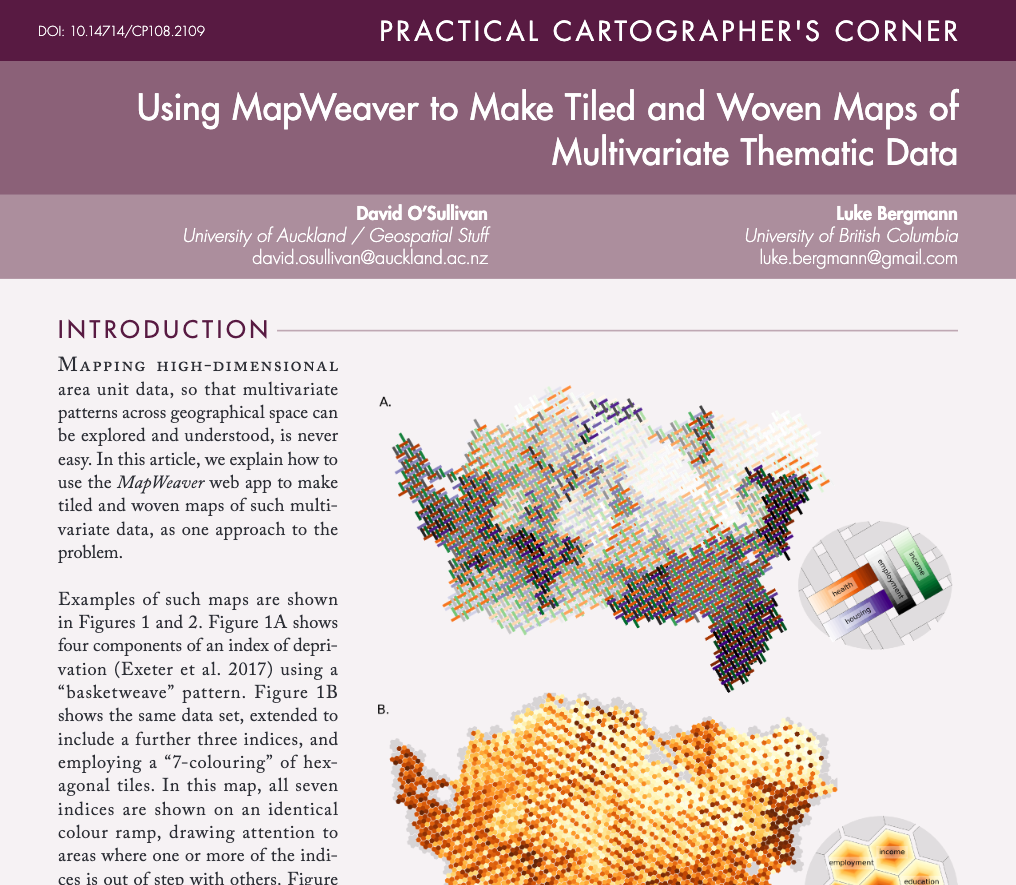
I’ve posted a couple of times about MapWeaver the app I built using marimo to make it easy(ish) to make multivariate thematic maps based on tiled and woven patterns.
We’ve written a short article on how to use the app. The app is free to use, and the article is freely available thanks to the good people at Cartographic Perspectives.
Here’s the citation details, and a link:
O’Sullivan D and L Bergmann. 2026. Using MapWeaver to Make Tiled and Woven Maps of Multivariate Thematic Data. Cartographic Perspectives 108. doi: 10.14714/CP108.2109.
To really dig into making such maps you might still need to write some code using the python weavingspace module, BUT MapWeaver handles almost all use-cases and let’s you export your map to PNG, SVG, geojson or geopackage formats for further design work in your preferred graphical or cartographic platform.
If you’re interested in this approach to mapping, and are looking for advice from the world’s most experienced1 tiled/woven thematic map maker, get in touch!
![]()
Footnotes
While writing the code I have made literally thousands of these maps!↩︎